
How to Evaluate a Surf Property Before You Buy: A Due-Diligence Checklist
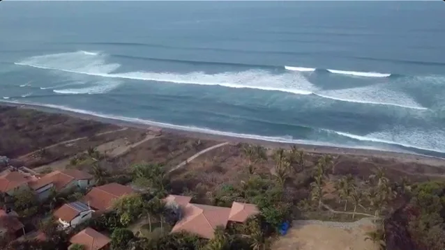
Buying a surf property is two purchases in one. You are buying a piece of land and a building, with all the usual questions about title, permits and cost. You are also buying access to a surf lifestyle, that cannot be compared to anything else. This is a passion real estate purchase. You have to take into account: what are the best months to surf there, which winds groom it, which tides it likes and how often it actually breaks. A listing photo taken on the best day of the year tells you almost nothing about either.
Quick answer: To evaluate a surf property, check four things before you commit money. The surf: confirm the break faces the swells that arrive in the months you will be there, that the prevailing winds are calm or offshore at least part of the day, and know the best tides in which the wave works best. The land: check erosion, flood, storm and tsunami exposure, and any public beach or maritime zone setbacks. The paperwork: confirm title, permits, zoning, legal access and whether a foreign buyer can hold the property. The numbers: price in maintenance, rental rates (if looking for a return on investment, ROI), taxes and resale. Visit the property before you sign if possible. ISP has sold a few properties in which the buyer could not tour directly, so ISP set up a live walk through the property with the buyer asking the questions and seeing what they needed to see.
This guide walks through each of those areas in the order most buyers should tackle them, then gives you a printable checklist, the red flags that should slow you down, and answers to the questions we hear most often. If you are still choosing a region, start with our guide to the best surf towns to live and buy property.
Not legal, tax or financial advice. This article is general information. Property, coastal and tax rules differ by country, change over time and apply differently to each buyer. Hire an independent local attorney before you sign anything or send money. ISP can help you find the right legal representation.
Table of contents
Reading the surf: will the wave work when you are there?
Most surf property buyers fall for a wave they surfed on a good trip. The job of due diligence is to find out how often that wave is actually good, and in which months. International Surf Properties (ISP) has a full overview of surf breaks in the area of your potential property.
Swell window and exposure
Ocean swell is energy from distant storms that has traveled out of the area where it was generated. NOAA describes swell as waves that "outrun the storm that creates them," growing longer and more regular as they travel (NOAA JetStream). Local wind makes shorter, choppier wind waves on top of that.
A break's swell window is the range of directions from which swell can reach it without being blocked. Islands, headlands, bays and the shape of the coast all narrow that window. Swell direction is always described by where the swell comes from. A "south swell" travels from the south toward the north, so a beach facing south or southwest is exposed to it, while a beach tucked behind a headland to its south may barely see it.
For any property you are considering, find out:
Which direction the coastline faces. Look at a map or satellite view and note the rough compass bearing of the beach.
Which swell directions the break needs. Local surfers, surf shops and surf guides will tell you. A point that "only works on a big south swell" is a very different asset from a beach that picks up almost anything. International Surf Properties (ISP) has a full overview of surf breaks in the area of your potential property.
What blocks the window. Offshore islands, reefs and neighboring headlands can shadow a spot from some directions.
As swell reaches shallower water, it starts to interact with the bottom. Its direction can bend with the contour of the seafloor and coast, and the waves grow and eventually break as surf (NOAA JetStream). That bending, called refraction, is why a swell can wrap around a headland and still break well on the other side.
Wind: offshore, onshore and cross-shore
Wind is the other half of the story.
Offshore wind blows from the land out to sea. It holds up the face of the wave and grooms it, which is what surfers want.
Onshore wind blows from the sea toward the land. It pushes the tops of the waves over early and makes the surface bumpy.
Cross-shore wind blows roughly parallel to the beach and can be fine or messy depending on strength and the shape of the break.
On many coasts the wind is lighter or offshore early in the morning and turns onshore as the land heats up during the day. Ask locals about the typical daily and seasonal wind pattern, and check whether the prevailing trade winds or seasonal winds blow offshore or onshore at your break. A spot with great swell exposure and a persistent onshore wind will disappoint you more often than the swell charts suggest.
Tide dependence
Tide changes the depth of water over the sandbar, reef or point, and many breaks work well only on part of the tide. Some reefs become too shallow to surf safely at low tide. Some beach breaks close out or lose their shape at certain tides. Ask which tides the wave works on, then look at a tide table for the months you plan to be there. If the wave only works on a mid-to-low tide and that falls in the middle of your workday most weeks, factor that in.
Wave type: beach, point and reef breaks
Wave typeHow it breaksWhat to know as a buyerBeach breakWaves break over sandbars along a beachOften more forgiving and usually works on many swell directions, but sandbars shift with storms, river flow and seasons, so quality can change from year to yearPoint breakSwell wraps around a headland or point and peels along itCan produce long, consistent rides, but often needs swell from a narrower range of directions and draws crowds when it's goodReef breakWaves break over rock or coral reefShape tends to be consistent because the bottom doesn't move, but shallow reefs raise the injury risk and some only work on specific tidesRiver-mouth breakWaves break over sand deposited where a river meets the seaQuality depends on rainfall and river flow, and the land nearby can be flood-prone or legally protected
Consistency by season
Every coast has a surf season driven by where the big storms are at different times of year. On Central America's Pacific coast, for example, Southern Hemisphere swells arrive mainly from about April to October, which is why many breaks there are far more consistent in those months. Hawaii's north-facing shores get their biggest surf in the Northern Hemisphere winter. Your question is simple: how many days a month is this wave good in the months I will actually be here?
How to use buoy data and forecast archives
You do not need to be a meteorologist, but a few minutes with real data beats any sales description.
Offshore buoys. NOAA's National Data Buoy Center (NDBC) publishes live and historical observations from its buoy network (NDBC). The key fields are significant wave height (WVHT), dominant wave period (DPD) and mean wave direction (MWD). NDBC defines MWD as "the direction from which the waves at the dominant period (DPD) are coming," in degrees from true north (NDBC measurement descriptions).
Swell versus wind waves. NDBC notes that swells come in at a longer period than waves produced by the local wind (NDBC wave glossary). A long-period swell from inside your break's window is what you want to see.
Forecast archives and statistics. Many surf forecasting services show past conditions and long-term swell and wind statistics by month for well-known spots. Look at the months you care about, not the annual average.
A surf log. If you can, check the forecast every day for a few weeks before and during your visit, and compare it with what the wave actually did.
Remember that buoys sit offshore. The waves at your break depend on the swell window, the bottom and the local wind, so use buoy data to understand patterns, not to predict exact wave heights on the beach.
When we bought the La Jolla de Guasacate in Nicaragua and then moved to Pavones we used the available information to know the best swells for both places. For example we learned the best swell direction (window) for Pavones is 180° to 235° (South to Southwest), with a sweet spot right around 195° (SSW), and a preferred period of 14 to 19 seconds.
Jim Habig, Director International Surf Properties
Visit once in peak surf season to see the wave at its best and the lineup at its busiest. Visit again in the off-season to see how often it is flat or blown out, what the town feels like, whether the roads flood, and whether restaurants and services stay open. Many regrets start with a single visit in the best month of the year.
We quickly learned the offshore winds blew over 90% of the time in the Popoyo region of Nicaragua and water temps in the 82°F to 86°F. But we quickly learned the Papagayo winds blew in February and sometimes dropped the water temps to low 70's.
Jim Habig
The location: access, crowds and the local lineup
Distance and walkability to the break
"Close to the surf" can mean a two-minute walk or a 20-minute drive down a dirt road. Walk the route yourself, with a board, at the time of day you would surf. Check whether the path crosses a river, a steep bluff or someone else's land, and whether it is passable in the rainy season.
Legal access to the beach
In many countries the beach itself is public, but the land between your property and the sand may not be. Confirm with your attorney and surveyor that the property has a legal, recorded right of access to the public road and, if it matters to you, to the beach. An informal path across a neighbor's land can be fenced off tomorrow.
Crowds and local surf etiquette
A good wave in an accessible spot will be crowded when it breaks, and more homes nearby usually means more surfers. Watch the lineup on a good day. Learn the basic etiquette: the surfer closest to the peak has priority, you do not drop in on someone already riding, and when paddling out you go wide rather than through the path of someone riding a wave. Some breaks have a strong local hierarchy, and localism can range from cold shoulders to real hostility. Owning a house near the break does not buy you a place in the lineup. Respect, patience and time in the community do.
The land: erosion, storms, flooding and setbacks
This is where the most expensive surprises hide. The closer a property sits to the water, the more of these questions matter.
Coastal erosion and shoreline change
Beaches move. Look for fresh scarps in the dunes, exposed roots, damaged seawalls, stairs that end in midair and neighboring buildings that have been abandoned or armored. Compare old and new satellite imagery to see whether the vegetation line has moved. Ask neighbors how the beach changed after the last big storm season. A lot that is 60 meters from the water today may not be in 20 years.
Storm surge, hurricanes and cyclones
In the Atlantic, the official hurricane season runs from June 1 to November 30. In the eastern Pacific, it runs from May 15 to November 30 (National Hurricane Center). The Southern Hemisphere and the western Pacific have their own cyclone and typhoon seasons. NOAA's Historical Hurricane Tracks tool lets you search storm tracks by place name and includes global data going back more than 150 years (NOAA Ocean Service). Look at how many storms have passed close to the property, and ask how the house fared in the last one.
Tsunami exposure
On coasts near subduction zones, tsunamis are a real, if rare, hazard. The U.S. Tsunami Warning System's guidance is clear: if you feel strong or long shaking, hear a loud roar from the ocean or see the water suddenly recede, move to high ground or inland immediately, ideally to at least 100 feet above sea level or a mile inland (Tsunami.gov FAQ). When you evaluate a low-lying beach property, check whether there is high ground you could reach on foot in a few minutes, and whether the town has marked evacuation routes.
Flood zones and elevation
In the United States and its territories, FEMA's Flood Map Service Center is the official public source for flood hazard maps used by the National Flood Insurance Program (FEMA Flood Map Service Center). On the coast, pay attention to Zone V and VE, which FEMA defines as "coastal areas with a 1% or greater chance of flooding and an additional hazard associated with storm waves." FEMA notes that these areas have a 26% chance of flooding over the life of a 30-year mortgage (FEMA, Zone VE).
Outside the U.S., official flood maps may not exist or may be hard to get. ThinkHazard, a free tool from the World Bank's GFDRR program, gives a screening-level view of coastal flood, tsunami, cyclone, landslide and other hazards for locations worldwide (ThinkHazard). Use it as a starting point, then ask a local engineer or surveyor for the lot's actual elevation above high tide.
Soil and geotechnical conditions
Sand, fill, clay, steep slopes and cliff edges all behave differently. Ask for a geotechnical report or have an engineer check the soil before you build or buy an older house. Look for cracks, sinking floors and signs of slope movement. On bluff-top lots, ask how fast the bluff is retreating.
Environmental protections
Mangroves, wetlands, dunes, river mouths and sea turtle nesting beaches are often protected. In Costa Rica, for example, the maritime zone law treats mangroves and estuaries as public zone regardless of their size (Corporación GC, summary of Law 6043). In Florida, the state's Coastal Construction Control Line program applies special siting and design rules to construction near the beach, partly to protect dunes and sea turtles (Florida DEP, CCCL Program), and the state has published a model sea turtle lighting ordinance for local governments to consider (Florida DEP, Rule 62B-55). Rules like these can limit where you build, how you light the house and what you can clear.
Maritime zones and public beach setbacks
Many countries keep the first strip of land along the coast in public hands. Two examples buyers in Latin America run into most often:
Mexico's ZOFEMAT. Mexico's government defines the Zona Federal Marítimo Terrestre as the 20-meter-wide strip of firm, passable land adjacent to the beach. It is federal property administered by SEMARNAT, with PROFEPA responsible for oversight (PROFEPA, Government of Mexico). Private use of that strip, such as a pool deck or beach club, generally requires a federal concession. Reform proposals to narrow the zone have been put forward in Mexico's Congress (Bustamante + Freyre), so confirm the current rule with your attorney. Separately, foreigners hold residential property within 50 km of the coast through a bank trust (fideicomiso) under Mexico's Foreign Investment Law (Ley de Inversión Extranjera, Art. 10). Our guide Can Americans buy property in Mexico? explains how that works.
Costa Rica's 200-meter maritime zone. Under Law 6043, the maritime-terrestrial zone is a 200-meter strip measured from the ordinary high-tide line. The first 50 meters are public zone (zona publica). In the remaining 150 meters, the restricted zone (zona maritima), the municipality can grant concessions of five to twenty years, generally only where a coastal regulatory plan is in place. Concessions can't be granted to foreigners with less than five years of residency or to companies more than 50% foreign-owned (Corporación GC; Officium Legal). Our guide to buying property in Costa Rica covers the details.
The practical lesson is the same everywhere: have a surveyor locate the high-tide line and the legal setback on the ground, and make sure the house, pool and any future plans sit on land you can actually own or legally use.
Utilities: water, power, internet and septic
Water
Water is the utility most likely to derail a rural coastal purchase. Find out where the water comes from: a municipal system, a community water association, a well, a spring or trucked delivery. In many countries, a well needs a permit or concession from the national water authority, and a building permit may require proof that water is available. In rural Costa Rica, for example, many homes are served by community water associations known as ASADAs. Ask for the documents, test the water quality, and check for saltwater intrusion in wells close to the beach.
Power
Ask how often the power goes out and for how long, especially during storm season. Solar with battery storage is common at remote coastal properties, but salt air, heat and humidity shorten the life of inverters, panel mounting hardware and batteries if they are not specified for the coast. A backup generator is still standard in many surf towns.
Internet
Reliable internet decides whether you can work from the property and whether rental guests will book it. Test the mobile signal at the house, ask neighbors which providers they use, and check Starlink availability for the exact address on Starlink's own website. Do not rely on a listing's "fast Wi-Fi" line.
Septic and wastewater
Most rural coastal homes use septic systems. Ask where the tank and drain field are, when the system was last pumped and inspected, and whether it was permitted. A high water table, sandy soil and heavy rain can all cause failures, and a leaking system near the beach is both a health problem and a legal one.
Legal due diligence
Title search and survey
Have your own attorney search the public registry to confirm the seller is the registered owner and that there are no mortgages, liens, pending lawsuits or annotations against the property. Order a new survey and compare it with the registered plan and the physical boundaries on the ground. In some markets, parcels are sold with possession rights rather than registered title, which carries very different risk. Our Pavones, Costa Rica guide shows how that plays out in one surf town.
Foreign ownership rules
Rules for foreign buyers vary widely. Some countries let foreigners own titled land directly on the same terms as citizens. Others require a bank trust, a local company or a long-term lease, or limit foreign ownership near coasts and borders. Find out what structure you will be using before you make an offer, and how it affects financing, inheritance, rental income and resale. Our country guides for Mexico, Costa Rica, Nicaragua (Popoyo) and El Salvador cover the local rules.
Permits, zoning and HOA rules
Confirm that every existing structure was built with permits and matches the approved plans. Ask the municipality what the zoning allows on the lot: height limits, lot coverage, setbacks, commercial use and short-term rentals. If the property sits in a gated community or condominium, read the association's rules, budget, reserve fund and recent meeting minutes. Association rules can ban rentals, restrict building styles or bring surprise special assessments.
Your own attorney, notary and escrow
Hire an attorney who represents only you, not the seller, the developer or the agent. In many civil-law countries, a notary handles the closing, and the notary's role may not include protecting your interests, so your attorney should review everything first. Use a reputable escrow service for deposits and the balance, and never wire money to a seller's personal account.
We were selling a beautiful parcel of land above Pavones. Upon inspection with a water engineer we hired, we found the buyer's intended use for the property could no be realized.
Jim Habig, ISP Director
The money: rentals, insurance, resale and running costs
Rental demand and seasonality
If you plan to rent the property when you are not there, estimate income from the whole year, not the peak month. Surf rentals are seasonal. Ask local property managers for real occupancy and nightly rates for comparable homes, and check what share of the year the wave is good, since that is when surfers book.
Short-term rental licensing
Many towns and countries require registration, business licenses, tourism permits or tax registration for short-term rentals, and some restrict or ban them in certain zones. Rules change often. Confirm the current requirements with the municipality and your attorney before counting on rental income.
Insurance in coastal hazard areas
Get insurance quotes before you make an offer, not after. In the U.S., FEMA notes that most homeowners insurance does not cover flood damage, that flood insurance is a separate policy and that there is typically a 30-day waiting period before an NFIP policy takes effect (FEMA, Flood Insurance). Outside the U.S., windstorm, flood and earthquake cover can be limited, expensive or unavailable for some beachfront buildings. If you can't insure it, factor the full replacement cost into your risk.
Resale liquidity
Surf property markets are often thin. A unique house on a remote point may take a long time to sell, and your buyer pool may be mostly foreigners who face the same ownership and financing hurdles you did. Ask how long comparable properties have taken to sell, and whether local financing exists for buyers.
Currency, taxes and carrying costs
If you earn in one currency and buy, maintain or rent in another, exchange rates will move your real costs and returns. Ask a tax adviser about transfer taxes and closing costs, annual property tax, tax on rental income in the country where the property sits, capital gains tax on sale, and your reporting obligations at home. Then add the carrying costs: insurance, property management, caretaking, security, utilities, association dues and repairs.
Salt-air maintenance
The ocean is hard on buildings. Salt spray corrodes metal fixtures, hinges, appliances, air-conditioning units and electrical connections. Humidity invites mold, and in the tropics termites attack wood. Budget for more frequent painting, sealing and replacement than you would inland, and favor marine-grade stainless steel, treated or naturally durable woods and good ventilation.
The surf property due-diligence checklist
Print this list and work through it before you make an offer, and again before you close.
The surf
Coastline orientation and the break's swell window confirmed
Swell directions and seasons that work at the break identified
Prevailing wind direction checked: offshore, onshore or cross-shore, and at what time of day
Tides the wave works on checked against a tide table for your months
Wave type (beach, point, reef, river mouth) understood, including hazards
Buoy data and forecast history reviewed for the months you will be there
Property visited in both peak and off-season
The location
Walked the route to the break, with a board, in the wet season if possible
Legal, recorded access to the road and beach confirmed
Lineup watched on a good day, and local etiquette understood
The land
Erosion history reviewed with old and new imagery and neighbors' accounts
Storm, hurricane or cyclone history checked
Tsunami exposure and nearest high ground identified
Flood zone and actual elevation above high tide confirmed
Sea-level rise exposure considered
Soil or geotechnical report obtained where needed
Environmental protections (mangroves, dunes, turtle nesting, rivers) checked
Maritime zone or public beach setback located on the ground by a surveyor
Utilities
Water source documented and permitted, and water tested
Power reliability, backup and solar condition checked
Internet tested at the property
Septic system location, permit and condition confirmed
Legal
Independent local attorney hired
Title search completed, with no liens, lawsuits or annotations
New survey matches the registered plan and the boundaries on the ground
Ownership structure for a foreign buyer confirmed
Building permits, zoning and rental rules confirmed with the municipality
HOA or condominium rules, budget and minutes reviewed
Escrow arranged for all payments
The money
Realistic annual rental income estimated from local managers
Short-term rental licensing requirements confirmed
Insurance quotes obtained before the offer
Resale history and time on market for comparables reviewed
Taxes, closing costs and currency exposure reviewed with an adviser
Annual carrying and salt-air maintenance costs budgeted
Red flags that should slow you down
The seller or agent pushes you to use their attorney or notary, or discourages an independent review. International Surf Properties always suggests the best possible representation in any particular area.
No registered title, only possession rights, a promise that title is "coming," or a survey that does not match the land.
Structures inside a public beach zone or maritime setback without a valid, recorded concession or permit.
Fresh erosion, repaired seawalls or neighbors' abandoned buildings along the same stretch of beach.
No documented water source, or a well with no permit.
Rental projections based on peak-season rates or on a single strong year.
You can't get insurance quotes, or the only quotes exclude wind or flood.
Access to the property or the beach depends on a neighbor's goodwill rather than a recorded right of way.
Pressure to wire money quickly, especially to a personal account or a changed bank account in a last-minute email.
Unpermitted additions, or a pool, deck or second unit that doesn't appear on the approved plans.
Frequently asked questions
What is the most important thing to check before buying a surf property?
Legal title and the property's position relative to any public beach or maritime zone come first, because they decide what you actually own. After that, check whether the wave works in the months you will be there. A beautiful house on insecure land, or next to a wave that is rarely good in your season, is a poor buy at any price.
How can I tell if a surf break is consistent?
Find out which swell directions and seasons the break needs, then look at historical buoy data and forecast statistics for the months you care about. NOAA's NDBC buoys report wave height, dominant period and the direction waves are coming from. Talk to local surfers and surf shops, and if you can, visit in both peak and off-season. International Surf Properties (ISP) has a full overview of surf breaks in the area of your potential property.
What does offshore wind mean for a surf property?
Offshore wind blows from the land toward the sea. It holds up and grooms the face of the waves, which usually makes for better surf. Onshore wind blows from the sea toward the land and tends to make waves choppy and crumbly. A break that gets offshore wind regularly, even if only in the mornings, is more valuable than one that is usually onshore.
Can I own property right on the beach?
It depends on the country. Many countries keep the beach and a strip of land behind it in public hands. Mexico's federal maritime zone (ZOFEMAT) is a 20-meter strip of land adjacent to the beach, and in Costa Rica the first 50 meters from the ordinary high-tide line (zona publica) are public and the next 150 meters can only be held by concession (zona maritima). Ask your attorney and surveyor where the line falls on the property.
Do I need flood insurance for a beachfront property?
If the property is in the U.S. and in a coastal flood zone, flood insurance is strongly advisable, and FEMA says it is required for properties in high-risk flood zones financed with a government-backed loan. Most standard homeowners policies do not cover flood. Outside the U.S., coverage for flood and windstorm varies by country and insurer. Get quotes before you make an offer.
How many times should I visit before buying?
At least twice if you can: once in peak surf season and once in the off-season. The off-season visit shows you how often the wave is flat or blown out, what services stay open, and how the roads and drainage hold up in the rain.
Should I use the seller's lawyer to save money?
No. Hire an attorney who represents only you. The seller's attorney, the developer's attorney or a closing notary may not be looking out for your interests. Independent legal review is one of the smallest costs of the purchase and one of the most important protections you have.
The bottom line
The best surf properties hold up on every test, not just the one you took on your best surf day. Check that the wave works when you will be there, that the land is safe from the hazards you can foresee, that you can legally own and use what you are paying for, and that the numbers still make sense in a slow season. Do the work, visit twice, and hire your own professionals.
When you are ready to look, browse surf and beachfront properties for sale, explore waves in our surf breaks directory, or search lots and land if you plan to build. If you are weighing Mexico, read our guide to Mexico surf towns. If you are thinking about a small hotel or surf camp, see our surf resorts for sale guide. Have a surf property to sell? List it with us.
Disclaimer: This article is general information, not legal, tax, insurance or investment advice. Laws, hazard maps, insurance availability and rental rules change. Verify everything with qualified local professionals before you buy.
Sources
NOAA JetStream, "Waves": https://www.noaa.gov/jetstream/ocean/waves
NOAA National Data Buoy Center: https://www.ndbc.noaa.gov/
NDBC, measurement descriptions: https://www.ndbc.noaa.gov/faq/measdes.shtml
NDBC, glossary of wave terms: https://www.ndbc.noaa.gov/waveobs.shtml
National Hurricane Center, tropical cyclone climatology: https://www.nhc.noaa.gov/climo/
NOAA Ocean Service, Historical Hurricane Tracks: https://oceanservice.noaa.gov/news/historical-hurricanes/
U.S. Tsunami Warning System, FAQ: https://www.tsunami.gov/?page=tsunamiFAQ
FEMA, Flood Map Service Center: https://msc.fema.gov/portal/home
FEMA, Zone VE glossary entry: https://www.fema.gov/about/glossary/zone-ve-and-v1-30
FEMA, Flood Insurance: https://www.fema.gov/flood-insurance
NOAA Office for Coastal Management, Sea Level Rise Viewer: https://coast.noaa.gov/slr/
GFDRR, ThinkHazard: https://thinkhazard.org/en/
Florida Department of Environmental Protection, Coastal Construction Control Line Program: https://floridadep.gov/rcp/coastal-construction-control-line
Florida Department of Environmental Protection, Rule 62B-55 Model Sea Turtle Lighting Ordinance: https://floridadep.gov/rcp/coastal-construction-control-line/content/28257-rule-62b-55-model-sea-turtle-lighting-ordinance
PROFEPA, "¿Qué es la Zona Federal Marítimo Terrestre?": https://www.gob.mx/profepa/acciones-y-programas/que-es-la-zona-federal-maritimo-terrestre-56672
Bustamante + Freyre, on the proposed ZOFEMAT reform: https://bmasf.mx/consideraciones-respecto-a-la-iniciativa-de-reforma-a-la-ley-que-recorta-la-zofemat-de-20-a-10-metros/
Ley de Inversión Extranjera (Mexico), Orden Jurídico Nacional: http://www.ordenjuridico.gob.mx/Documentos/Federal/html/wo14.html
Corporación GC, Zona Marítimo Terrestre (Law 6043): https://www.corporaciongc.com/areas/zona-maritimo-terrestre
Officium Legal, concessions in Costa Rica's maritime zone: https://blog.officiumlegal.com/es/zona-maritimo-terrestre/concesiones-en-la-zona-maritimo-terrestre-como-funcionan-y-quien-puede-obtenerlas
About the author
Jim Habig is the founder of International Surf Properties, a marketplace for surf-front and beachfront real estate around the world. A lifelong waterman and real estate professional, Jim started ISP to connect surfers and ocean lovers with homes and land near the waves they love, and to help them buy with clear, practical information. ISP is a listings marketplace, not a law firm; always work with independent local legal and tax professionals on any purchase.
Tags
Keep Reading
More From the Blog
 Buying & OwnershipBaja California
How to Sell Property Abroad as a US Owner: Taxes, Process and Timelines in Costa Rica, Mexico, Panama, Nicaragua and El Salvador
October 14, 2026
 Buying & Ownership
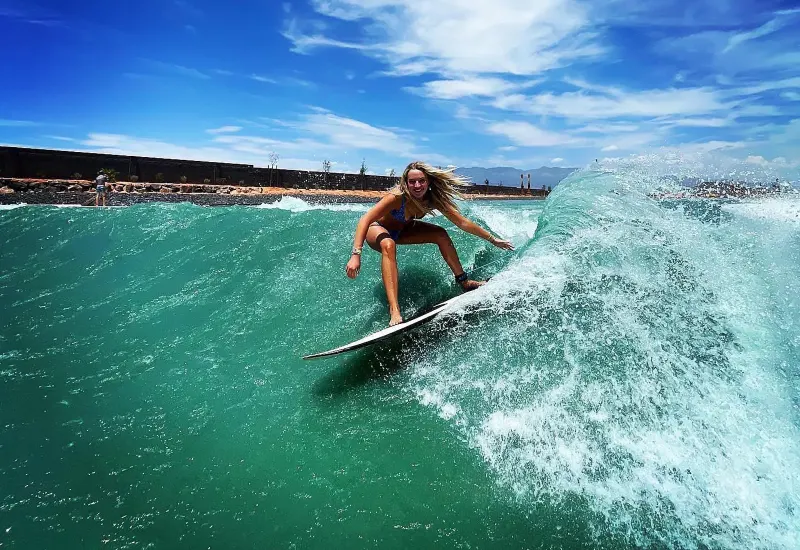
Wave Pool Homes: The 2026 Guide to Buying Real Estate in a Surf Park Community
October 11, 2026
 Buying & Ownership
Rosarito Real Estate: The 2026 Guide to Buying a Surf Home in Rosarito, Ensenada and Northern Baja
October 11, 2026